Mt. Baldy

Mt. Baldy

As footloose hikers we had decided to do two hikes every year. One in Spring and another one in Fall. Usually the Spring hikes are tricky since many mountains are snow covered and we are still a non technical climbing group.

So we chose Mt. Baldy in LA for the Memorial Day weekend in the Angeles National Forest in OC. I had heard from my manager at work that this was a high altitude gain hike near LA which was perfect as a practice hike for Mt. Whiney.

There were 3 trails going up the summit and we wanted to do the Bear Canyon Trail from Baldy village. The trail is 6.4 miles starting from the Baldy village @Baldy visitor center which goes up 6000 feet. This climb would also do justice to flying across the country to hike. We planned this hike in advance and this time we had few new members joining footloose hikers. We were going to be a big group for 11 people with different levels of hiking experience. The good thing was this was a day hike and if we paired up we could always return from anywhere on the trail.

The day before the hike we all met up in Ontario, CA. Given a big group with some new comers we decided to split into two groups, the first one with four people attempting on Bear Canyon Lake and the second taking the  scenic Icehouse Canyon Trail and trying one of the peaks around. This would also give the second group some sleep before the hike since we had to start from the hotel at 3 am for Baldy summit. With our past experience we had realized we were slow climbers and almost always had timing longer than average. At the visitor center they had told us the average time was ~8 hours and we were planning for that.

The next morning me, my sister Uttara and our friends Priya and Ruchir were up and ready to leave at 3.10am. That was a good start, leaving on time. The drive was close to 40 min and we parked outside the visitor center. The trail was 15 min away going through Baldy Church parking lot and we were at the trail head at 4.15 am.

It was almost a full moon light and was pretty. We had still not warmed up and started to pace ourselves for a long day hike. Always being scared of running out of water I was carrying more than required and felt my pack a little heavy. A mile into the hike I could feel my IT band complaining which was injured from running a month ago. We kept our heads down and kept walking. The trail was not marked and hardly had any signs. At one point we reached a dead end and realized we could have been off the trail at some point. It was still dark and we decided to start climbing down the way we came. It was not very hard to get back on trail and we had lost close to half an hour in this. As soon as we walked a few steps we saw a board indicating that was the right trail. That was the only one we saw on the entire trail.

We kept walking on the ridge and was an indication that it was the right trail. It was dawn and we loved it. Sunlight has always been a mental boost for me on the hikes. We decided to take a short breakfast break. I had shoved down half of PBJ before starting and was now working on the rest. We had carried a variety of food on the hike in terms of flavors and kind. Priya and Ruchir carried fruits on the hike and that turned out to be a great idea. Adding spicy and sweet mix worked well. We were off the trail mix and energy bars. Coconut water worked as a great electrolyte.

The trail kept getting steeper. We called this hike women power since it was three women and Ruchir. Priya had been doing cross fit and I could see the added strength making the difference for her. Uttara was doing great too and was close to Priya inspite of her back injury. Ruchir has always had a different way of hiking. He truly enjoyed taking videos and pictures. He would spend some time doing that and sometimes even run up the trail. I had not trained that well but over all could keep up. Being in a small group it was easier to stick together.

Soon we came to a ridge and could see the Big Horn Ridge. We were keeping track of the miles but was hard to see on the map where exactly we were. After being the only people on the trail we started seeing people now. The first one was a guy running up the trail. Most of the people we saw were older (but faster) or the young ones who were trail runners. We talked to them and realized we were around 1/3rd done.

Not thinking much we kept walking. I started to feel the fatigue. But because this was not a high altitude hike it helped a lot. It was close to 9.30 am and we climbed up to a flat portion. We met a guy who showed us the Devils backbone trail across the mountain. He said the hike would get less steep and we had to climb across a ridge to get to the summit. Although he said we might be half done. We had climbed 5 hours  including our little detour and half way did not sound good. It felt unrealistic too since we had gained a lot of altitude. Then we met an old Iranian guy who calculated we had 1.5 hours to go based on when we started and also showed us the summit. That was exciting and we continued.

The next hour and a half was just a matter of time. On this summit I was tired but far from hitting the wall and there was no question of whether or not we are going to make it to the summit. Priya was faster but we all took a 5 min break 15 min before the summit and made it up together.

Summit was great. For the first time in the day we saw so many people. It looked like the Big Bowl and Devils backbone trail were very popular. There was a big group doing pushups. Funny thing is we also had planned to do pushups on the top but ofcourse not those many.

We had lunch and were surprised to get coverage on our cell phones. Ruchir thought maybe we could climb down the Big Bowl trail just to save some time. It was 4000 feet in 4 miles vs. 6000 feet in 6.4 miles. We could get in touch with our group and they could give us a ride from Big Bowl parking lot to the visitor center. Initially I was reluctant and wanted to go back the trail we came. But my IT band had been hurting so decided on that and also it was really nice to climb down on a trail with so many people.

The moment I walked on the switchbacks of Big Bowl trail I was in excruciating pain because of my IT band and realized I could not bend my right leg. I popped two Advil pills hoping it would get better but it did not. We kept going and I got used to the pain. It was better in the parts where the trail was less steep. We made it down in 4 hours. Climb down is always boring but I missed walking on the trail we climbed. On the way down it nice to see what we climbed up especially in the dark. But I secretly liked the idea of being in pain for 2 less hours.

It was a great hike. Strenuous but not too bad. The group wants to do a scenic hike next but I am still stuck on Mt. Whitney. An unsuccessful summit attempt is hard to let go even though I have to choose between something beautiful like Glacier National Park in Montana. Need to see what happens this Fall.

Mt. Baldy Pictures

Standard
Auli

Auli, India

OLYMPUS DIGITAL CAMERA Start of the trip at Rishikesh India

Kissing rocks. Natural Bridge formation

OLYMPUS DIGITAL CAMERA OLYMPUS DIGITAL CAMERA

Shiva Temple              OLYMPUS DIGITAL CAMERA

OLYMPUS DIGITAL CAMERA Another old temple. A good resting spot.

View from hotel in Auli OLYMPUS DIGITAL CAMERA

NandaDevi Peak

OLYMPUS DIGITAL CAMERA

OLYMPUS DIGITAL CAMERA OLYMPUS DIGITAL CAMERA Start of the hike to Chandrashila Summit of Tunganath Temple. Tunganath is the highest Shiva Temple in the world. Hike started at Chopta


Tunganath Temple after the hike.OLYMPUS DIGITAL CAMERA OLYMPUS DIGITAL CAMERA

At Chandrashila summit. The views are supposed to be awesome but it was a very cloudy day. It was a great experience with family.                                                       OLYMPUS DIGITAL CAMERA OLYMPUS DIGITAL CAMERA At Deoria Tal. The lake is famous because of the legend that Gods bathed in itOLYMPUS DIGITAL CAMERA OLYMPUS DIGITAL CAMERA OLYMPUS DIGITAL CAMERA OLYMPUS DIGITAL CAMERA Dad enjoying the nature around Deoria Tal

OLYMPUS DIGITAL CAMERA Dev Prayag on the way back. It is a confluence of Bhaghirathi (Ganga) and Alaknanda rivers to be called Ganga riverOLYMPUS DIGITAL CAMERA

OLYMPUS DIGITAL CAMERABadrinath Temple, one of the four Char Dham (four holiest pilgrimage circuits)

Standard
Mt. Whitney

Mt. Whitney

It had been a while that I hiked. I used to hike in India, some short ones in Sahyadri Maharashtra and some long ones in Himalayas. But those were high school days and ever since I pursued higher studies and work, hiking was very limited. One evening after work it struck me that I do need to pursue my passion. I had recently run a half marathon and was in decent shape but always felt that mountains were missing in my life.

I was not sure who would I go with but I instantly pinged my college friend Amit with whom I would discuss hiking, running and fitness regularly. And what did I decide? Mount Whitney day hike! I knew the worst would be not being able to make it and return. I did not want the overhead of planning and camping. So we just decided to give it a shot.

Being in VA I flew across the country to LA at Amit’s place. The plan was to take a day off and then drive to Lone Pine a town at the base of Mt. Whitney. From my dad’s hiking experiences I knew that it was way too low an altitude to stay the night before the hike. We had plans to camp at the base of Whiney which did not work out. In the hindsight that probably was a must.

We drove to Lone Pine and reached the afternoon before the summit day. In order to acclimatize we did a short on Whitney trail after picking up the day permits.

Lone Pine Lake @Acclimatization hike

Lone Pine Lake @Acclimatization hike

By the time we packed our bags for the hike and had dinner we knew we would barely get any sleep before the hike. I packed around 4L water assuming I would need a lot. The bag was quiet heavy for a really long day.

We were up at 2am ready to leave. By the time we started from Whitney portal it was close to 2.30 am.

Start of the hike @Whitney Portal

Start of the hike @Whitney Portal

I had not eaten much and started to feel tired almost 1-2 hours into the hike. It was extremely cold and we crossed a few small water falls. I realized I was carrying way too much load and should have studied the mountain for water sources.

Sunrise on the trail

Sunrise on the trail

I could maintain a decent pace but started slowing down close to 12,000 feet. Amit offered to carry some of my water and wait for me ahead on the trail. Being inexperienced that was another blunder we made. We had no split up plan and over that most of my water was with Amit. I got to the camp site of Whitney and realized I could have taken water purification tablets and just filled water there. By now I could feel the fatigue. The sun and the heat was beating down on me. It was a hot day really with temperature close to 96F.

Still a way to go

Still a way to go

Amit probably was tired of waiting for me and assumed it would be ok to continue since I might not make it. We had a plan to start walking down by noon if we did not make it.  It was around 10.30 am and I started climbing from the camp site. The hike immediately after the camp was a steep climb and I was very slow. To add to that I was running out of water. One of the older guys on the trail saw that and mentioned it would not be a good idea to continue. Not that I had an option. I knew I had hit the wall. It was combination of lacking endurance, lack of experience in hiking, poor planning and not knowing my body well enough. Ego and will power could take me only so far. I realized I had to return. I had to accept 13,000 feet was the max I could go that day. As I walked down there were number of hikers going back to the camp. The old guy had told many people up on the trail that I am running low on water. Multiple people offered me water. One of the great things about hiking is seeing the humanity in hard conditions. I refilled my water from the lake near the camp and few helped me with the water filter.

I waited at the camp for sometime. There was no shade and the sun was intense. I tried to ask a few people who had come down to the camp if they had seen a short Indian guy. I think our ethnicity was helping us there. Few had seen him climb. But at the same time they were surprised that my “boy friend” left me alone on the mountain. I did try to give our relationship status saying he was my friend but later I realized it was in significant. I was not mad at Amit since I knew him for years. It was unintentional and lack of knowledge of consequences of climbing technically alone. Moreover I knew I wanted him to summit if he could. And he would have wanted the same if in my place.

Walk down was boring and surprisingly very long. Again because of our in-experience we were probably the only two people on the entire mountain without hiking poles. To me it seemed like a norm in US. I had never seen this in India nor had my father used it on any of his expeditions. But I felt maybe they might have helped since I was having hard timing climbing down fast. Speed has never been and maybe never will be my strong point. As long as I got back in time I would be fine.

I got back at 6.30 pm and went to the only small shop at the portal and decided to wait for Amit. He had the car keys and there was no way I could get anywhere. I started to get worried. For one I did not know how long Amit would take and I was not confident about him walking in the dark alone on the mountain. While I waited an Asian guy came and asked if I could buy him an Advil at the shop. I said sure and since I was having a beer got one for him too. He was also waiting for his group to return. I asked him if he had seen Amit and he said he saw my “boy friend” on the summit and he should be coming down.

Soon the shop closed and we were out waiting for people to return. His friends were all back but Amit still was not. It was freezing cold and we were told that the portal was not a safe place to hang out because of possible bear attacks. It was 8.30 pm and I was really worried. Also a little annoyed because I knew that Amit had pushed and not turned around in time. I remembered him mentioning he was not that great at balancing and knew he would be slow climbing down. I think at that point we were one of the last people at the portal. The asian guy and his friends offered to give me a ride back to the town. I knew I could not wait there alone and agreed. Since Amit had the keys to the car he could get back and call me.

Back in town we had dinner and they dropped me to a hotel. I had a good time with all of them. It did not feel like I met them for the first time. I think just being hikers we had some kind of connection. I checked in and had phone coverage. By then my sister and mom had called multiple times and were worried. I did not tell my mom Amit was still not back. I did not want them to be concerned especially since they could do very little about it at that moment. I was not sure where I could call for help. I was just hoping he had not twisted something and was not stuck and warm. I decided to give it a few hours and then explore help options.

I was beyond exhausted but could not sleep. Finally at midnight Amit called. He had been hiking for 22 hours. Ofcourse he made it to the summit but it took him 10 hours to climb down. When he got back he had to charge his phone at a gas station and call me. He mentioned that he was scared to come down on switchbacks on the top and it was really hard to walk back in the dark. He had also met a camper / hiker on the way down in dark who probably had altitude sickness and just wanted to come close to 10,000 feet and sleep in his bag. Amit walked with him and ensured he was safe. The guy gave him his hiking poles and asked him to keep them at the portal and he would collect them the next day. That probably saved Amit a few hours and increased confidence in walking in dark.

Anyways he was back. The next day driving back to LA we could not stop talking on the things we would do differently in the next hikes.

1. Study the mountain

2. Know how much food and water to carry. Too much and too little both were an issue.

3. Carry right gear

4. Have a split plan.

5. Hike in a larger group if possible.

6. Know your body. Everyone works differently but only with experience in a given sport we know what works best for us.

7. Acclimatize well if required.

8. Of course train. This is relative since it would be hard to know how much is really enough. Knowing the thin line of pushing and giving in to the mountain is still hard.

Amit still would not agree with many but we have different personalities. His positive attitude pushes me on the mountain where as my safe attitude makes me plan more for our hikes now (even for him).

I don’t know if I will be or if I am still prepared for Whitney day hike. I will know soon since I plan to give it another shot. Hopefully little wiser and may or maybe not little stronger.  What I learnt on this mountain surely helped me in my last few hikes.  Can’t wait to go back!

Standard
Zion Narrows

Hiking through the Zion Narrows in Virgin river

Zion Narrows Hike Overview

– Uttara Vaidya

BY: FOOTLOOSE HIKERS
24TH JUNE 2012
16 MILES
CAMPGROUND #12

OVERVIEW

We are a pretty disciplined group and planned a lot of hikes successfully in the past, but this hike threw us off big time. We fell short in our research – it was hard to find articles that describe this hike in detail and what it takes to finish in time and enjoy it at the same time. Hopefully this one will give a clear picture to all the ones who intend to do this hike.

TRAIL DETAILS

Length: 16 miles (of the river). After crossing the river many times throughout the hike the total distance walked could go upto 20 miles.
Elevation Gain: 1500 ft gradual descend.
Start: Chamberlain’s Ranch Trailhead
End: Temple of Sinawava

Important Mile Markers:


Water Depth

Mostly ankle – shin high water for Day 1 (until Camp #11).

Might encounter thigh deep waters between Camp #11 to #12. This is where the river starts getting deeper. Most people will encounter this on Day 2 unless they are staying at campgrounds #10 or later.

Few deeper encounters

  • Around wall street area
  • Waist high for a 5 ft person
  • longest was 25 ft – otherwise a few feet everytime.

Deepest Point in the river (just one such point)

  • Also comes way later in the hike – just before wall street
  • Chest deep for a 6 ft tall guy
  • 10 meters.


Rental Gear

We rented most of our gear from Zion Adventures.

  • Shoes: Apparently the best one they have for water hikes. Ankle high, supposedly good sole. Our experience? Not so good. After walking a few miles, we realized it would have been better if they werent ankle high for better movement of your feet. Your foot can twist 360 degrees throughout this hike and its best if you dont pull a muscle especially when its really bad on your knees. If you still have to go with these, make sure its 1/2 a size bigger to allow for all the water that seeps in and takes all the air space between your foot and the shoe.
  • Socks: Be very careful about choosing these too.
    • First of all their material is neither comfortable nor soft. They ended up giving multiple blisters to almost everyone in our group.
    • They dont have a zipper – which makes it very hard to keep wearing and removing them multiple times throughout the hike. Yes, we had to do it a few times just to feel lighter on our feet by removing the water weight. You might want to just buy them off for about 15 bucks on amazon.
    • They stink to the core – with a lot of people using them of course. But thats the least of the problem.
      Go for 1/2 a size bigger – for the same reason as mentioned under shoes – to accommodate for extra water, but make sure to carry a lot of bandaids for all the blisters it might give you anyways.
  • Life Jackets: Few people in our group either didn’t know swimming OR were hydrophobic (not a very comfortable feeling atleast for short people – 5 ft or shorter). Overall, it was a good decision to carry 1-2 life jackets for those members. Better safe than sorry and such members can atleast enjoy the hike rather than living in constant fear of encountering those deep areas.
  • Sleeping pads: The ones they rent out are pretty good. So go with it.
  • Sleeping bags: The ones they rent out are pretty heavy (4 1/2 LB+). We suggest carrying a lighter one that you own or rent from REI. Some of the people in our group decided to skip sleeping bags since it was high 80s to 90s during the day. Big mistake though, temperatures drop a lot in the canyon during nights and they highly recommend carrying sleeping bags. Skipping them – big no-no!
  • Dry Bags: They apparently have good ones. But this is still a gamble (for the ones they rent out) since water indeed seeped through some of our team members’ dry bags.
Lessons Learnt
  • Shop for good quality shoes and socks for such a long distance hike – its a must!
  • LEAVE EARLY! – Never under-estimate the time it takes. Especially this one, take the earlier 6:30 shuttle. This also give you enough time to really enjoy the hike rather then rushing it last minute.
  • Study the map, distances and time required for each day. Estimate based on the speed of the slowest person in the group, size of the group and the terrain. The estimates given in the map very very aggressive for a average hiker.
  • Must have a cheap watch – we lost track of the time since our fancy GPS watches drained their batteries out and we were not carrying any cell phones because of the water.
  • Discuss group split options beforehand. Each group should be self contained – should have enough water, food, tent, sleeping bags, headlamps and first aid.
  • Discuss emergency strategy before splitting – consider the dangers. eg. If it becomes dark and we have not reached our campsite. Figure out ways to communicate with the other group in worst case scenarios – in this case it would have been great if the faster group had left more informative messages for us with the other campers.
  • Ideally should have a way to communicate between split groups – Cell phones of course dont work in those areas. For our next hike, we will explore walkie-talkie as an option.
  • We need to give ourselves enough travel time before and after the hike so that we can sleep early the night before, catch up on good breakfast in the morning and on time and also have time to eat something before rushing to the airport after the hike.
  • Read reviews / blog by people who have done the hike and learn from their experience. Some things will never be highlighted in maps or by the visitor center that we learn from hiker reviews.
  • DO NOT leave sleeping bags behind thinking its 90s during the day! Temperatures drop in the canyon during nights its and its highly recommended you carry one.
  • Carry headlights with charged batteries AND one per person – dont even think about sharing them – especially for this hike. Also, weak headlights are totally useless – especially for water hike since the light has to penetrate through the water for you to see the bottom.


Good to Know
  • Carry water filters and iodine tablets
  • Carry poop bags
  • Carry life jackets depending on the month you are going and level of comfort with water. Earlier months such as May will have deep water and if you are scared of water OR dont know swimming, its highly recommended.
  • Carry extra warm clothes – in case you are drenched you have to have set of dry and warm clothes so you dont catch cold.
  • Hiking pole is an absolute MUST
Standard
Mt. Harvard (Colorado)

Mt. Harvard

Mount Harvard – 14er in CO hike

-Nishant Shah High Points:

  • Elevation gain – about 4550 ft.
  • Class 2 for most of the trail. Class 3 near the peak.
  • Total round-trip distance from North Cottonwood Creek Trailhead – 12.6mi.
  • North Cottonwood Creek Trailhead to Kroenke Lake – 1.5mi.
  • Kroenke Lake – Treeline/Start of Horn Fork Basin – 2mi.
  • Elevation at Treeline – 11600 ft.
  • Treeline – Bear Lake – 1.2mi.
  • Elevation at Bear Lake Junction – 12400 ft.

Getting there: It was about 2:45am when we started driving from the Collegiate Peaks campground (which is about 10 miles west towards Cottonwood Pass from main town Buena Vista) towards the North Cottonwood Creek Trailhead for starting our ascent. We took CR 306 going east (for about 8 miles or so) and then a left to take CR 361 (which goes north-south). The campground is at an elevation of 9800 feet but in driving to CR 361, there is a loss of about 1200 feet or so.  CR 361 leads to a sharp left that connects to CR 365 which eventually leads to the North Cottonwood Trailhead. The drive from the start of CR 365 to the trailhead is rocky and bumpy (4×4 highly recommended). This is where we made up for the loss of the elevation coming down from our campground. The drive climbs up to an elevation of about 9900 ft and for the most part is through the San Isabel National Forest. A few things to note about the trailhead:

  1. You will pass Silver Creek trailhead about 1.5 miles before getting to North Cottonwood trailhead
  2. There are no restrooms at North Cottonwood trailhead but there is one in the parking lot of Silver Creek trailhead
  3. There are no marked spots but plenty of parking space available near the North Cottonwood Creek trailhead

Ascent Route: The trail starts west of the parking spaces at the trailhead. The check-in register for the trail is maintained not at the trailhead but about 0.15 miles into the trail. By the time we signed in our log for the ascent of the 14er, it was about 4:15 am. The trail at the start is fairly level and at times become narrow. For about a mile and half the trail doesn’t climb much at which point comes a bridge crossing soon followed by a split. Going left at this split takes you to Kroenke Lake and staying right takes you towards the treeline, Horn Fork Basin and eventually to Mount Harvard! The next couple of miles are a little steep with hardly any switchbacks! Most of the trail here is rocky and along a ‘wash’. The trail levels off close to the treeline so much so that we could see a sprinkling of backcountry campers. Just before getting out of the treeline comes another ‘Y’ split. Take a left here to go towards Mount Harvard. We were now at the edge of the lush green Horn Fork Basin. For about a mile from here, one has to wade through willows and a very bushy trail. Just before a stream crossing you get a view of the peak of Mount Harvard and clear view of Mount Columbia on your right. The distances at this point are very deceptive! The hike through the lower part of the basin changes dramatically at the Bear Lake junction which is at an elevation of 12400 ft. The trail becomes a little more steep and rocky. The first rocky patch has some good boulders to hike through. The trail though, is clearly marked, with some neatly placed cairns. The rocks become smaller as one climbs up this patch and the trail levels out one final time before hitting the steepest portion of the climb with some interesting switchbacks! This part now marks the end of Horn Fork Basin area. – Nishant Shah We were a relatively large group ( it’s usual for us) and after 12000 feet we started feeling the effects of altitude. We continued at a slow pace so all of could walk as a group. Another half an hour into the trail we saw Mt. Harvard and it struck me that it would take us atleast another 2 hours to get to the top. Moreover I was not sure if everyone would make it. At this point we decided to start walking at our own pace and few members decided to head back. The last 1000 feet of the mountain were the toughest and like any other summit felt never ending. Me along with three other friends and my 60+ years old dad made it to the summit. Just then we heard some voices and we realized we might need to scramble over some rocks to make it what looked like a real summit. By then it was pretty late in the day and we could see dark clouds approaching. Our goal was to make it to the tree line before it started raining. We made it to the end in the rain. To our surprise the rest of the team was still waiting for us. This being my first successful 14ner and that too with my dad felt good. But at the same time I was wishing everyone else made it. But again as I see it climbing mountains successfully or not is an experience we learn from and try to make the next one better. As footloose hikers we end the hike with lessons learnt (mostly over beers). Some of the lessons stick, some mistakes repeat and of course there are new mistakes to make. But I hope we as a group continue to hike a lot more together. -Mukta Vaidya

Pictures @Mt. Harvard


Standard
Auden Col and Rudragaira

Auden Col and Rudragaira Peak

Image

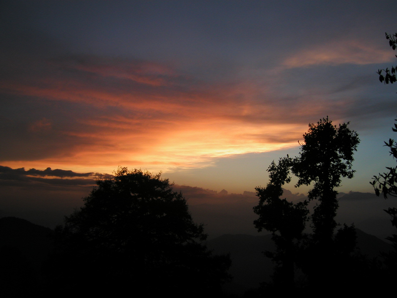
As I came out of the tent at midnight at Auden’s base, the moon was shining at its best, the snow peaks of Gangotri and Jogin range were silvery bright. The sky was dark with very little space for other stars as it was a full moon. The winds had stopped and it was very cold. I took out my camera and stand to grab pictures of the mountains, my hands were frozen in that attempt that went is vain. But I was all alone to experience that heavenly moment. Very selfish to be frank, I did not want to wake up others sleeping in the tents to enjoy and be part of the moment; I wanted to be part of the moment only myself. I stood enthralled for about 10 minutes in that very atmosphere when my intellect reminded about my freezing body and I went back to the sleeping bag.

The same night, I woke up again at 4 AM, came out of the tent. The moon had set behind Gangotri peaks and on the east, I could see Venus. Bright Venus is fond of poets and is a symbol of love. I remembered home looking at that site. Once again attempt to grab pictures went in vain and I went back to sleeping bag in the freezing cold.”
-Satyajit Chitale 
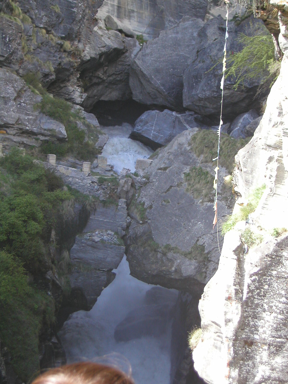
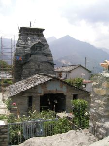
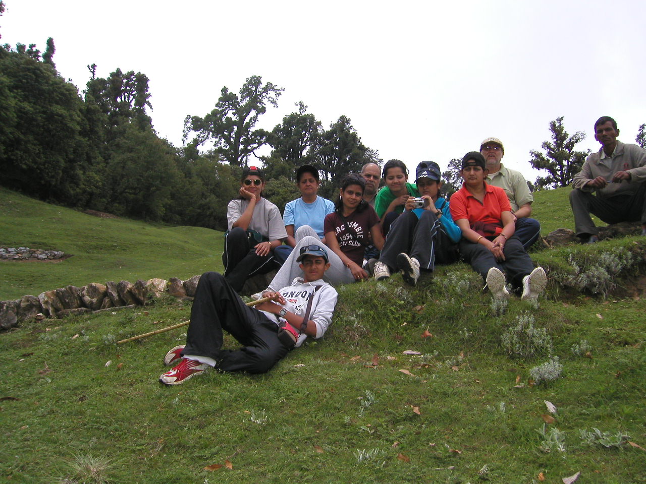
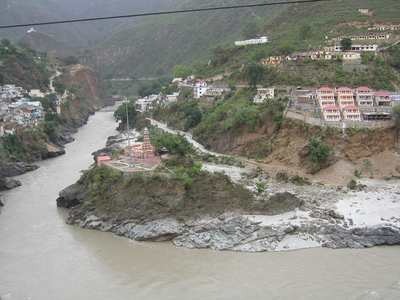
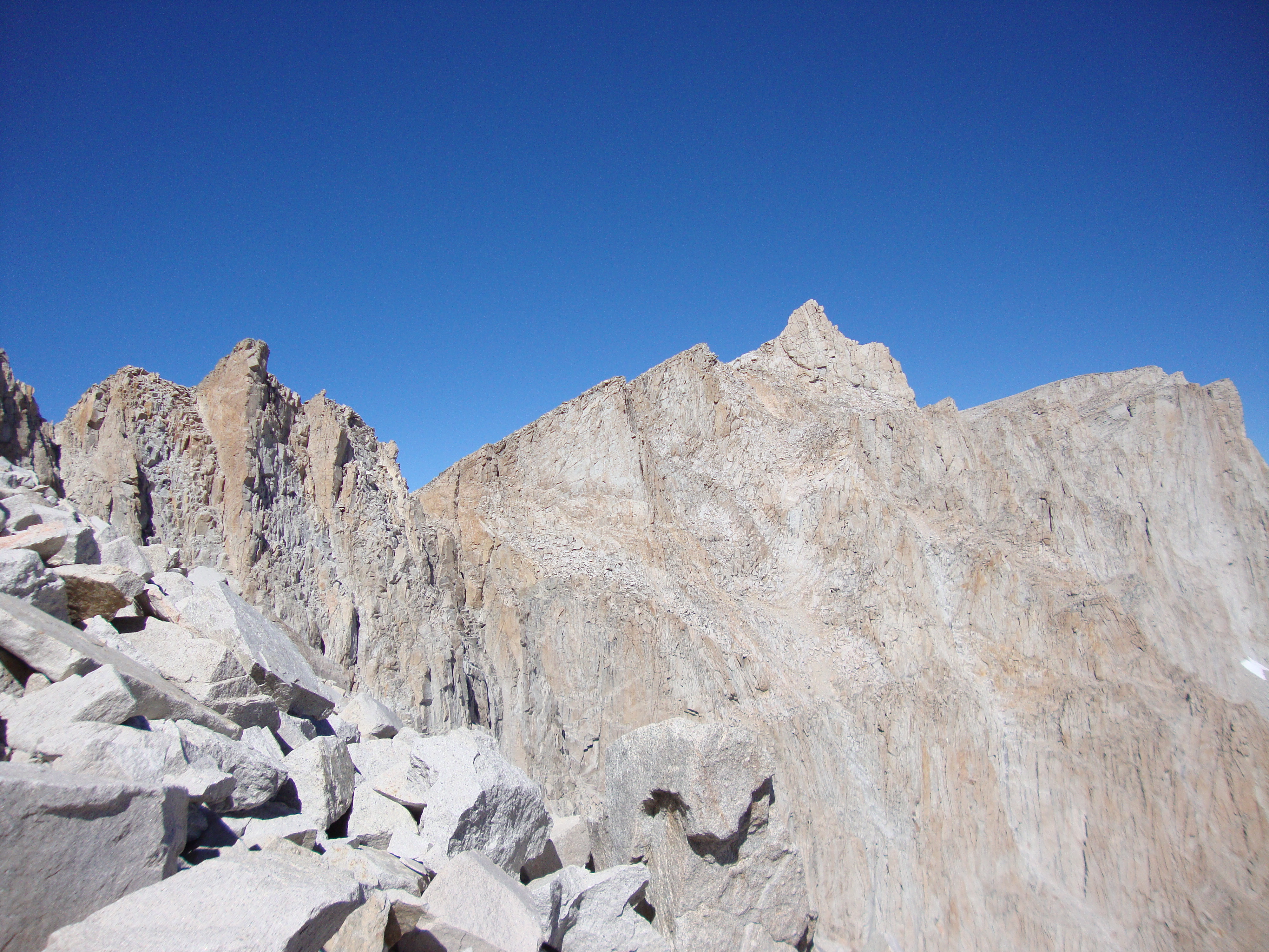
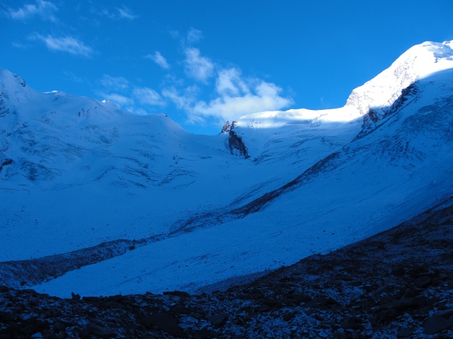
Sitting here at the base of Auden’s Col is an experience like never before. When I feel the cold, the wind and the altitude of 16000 ft, I wonder what brings us here. For one, I always wanted to experience a long hike with my experienced climber dad. And so glad to have attempted the Col and back safe. Today morning we woke up at 0530 AM. The plan was to start climbing to the top of the Col and continue the hike to Kedarnath. But due to some problem with our organizer, technical help did not show up, which we waited from beginning of the trek on 25th Sept. Hence we decided to go as far as possible and return. But even that turned out to be a challenge today morning. The subzero temperature and gusty winds made every step painful. With frozen hands and feet, all I wanted was Sun to heat us up. After an hour the Sun warmed us up. By that time we were climbing on the glacier towards Auden’s Col which we could distinctly see right in-front of us. It looked so close yet so far. Our estimate was that the Col would be at 18,500 ft. At 0930, after almost 2.5 hrs of climb we were close to a mine of crevices. They were all over the glacier calmly lying across. We all, porters and members, roped ourselves and continued to walk. After another half an hour it was hard to know where exactly the crevices were starting and if we were over one of them. The Col would have been hard to climb with the terrain and we had to get back to BC before noon due to expected snow fall in the afternoon. We all decided to head back and reached the BC at 1200 hrs. Nikhil’s GPS indicated that we reached the altitude of 17,000 ft. Tomorrow we will go back the same way, we came here from Gangotri.We four reached Gangotri last Sunday, the 23rd Sep, from Uttarkashi. At Gangotri, one of the four pilgrimage places (Char Dham) there is a temple at 9,900 ft. It is considered as the origin of holy river Bhagirathi, which eventually becomes Ganga at Dev Prayag with confluence with Alaknanda. Gangotri is a small place with a few tourists at this time of the year. It had started to get cold and within a month, the whole place would be drowning in snow. We attended the evening prayer of holy Bhagirathi. Next morning, we started acclimatization walk on the same route as our hike to Auden’s Col. The trail was through the woods and we climbed up to 10,700 ft.We got back and spent rest of the day waiting for the crew to show up. We were a team of me,dad, Satyajeet & Nikhil (leader) and supposedly, 15 porters, a guide and a lead of porters. It was 0600 pm and we did not hear about the crew. The cell phones were not working. We had no choice but to wait. We finally got connected from one of the locals (Jai Prakash) and came to know that everyone was on the way. Later at 9 PM we met a few porters. There were 8 porters but no guide, mate and equipment. Next day, we spoke to Himalaya Sherpa, the organizer and we had to start our hike. He promised to send the remaining team the next day since we were to climb slower than them, to get acclimatized. After walking the first day for 4.5 hrs, we decided to camp at Bhoj Kharg at 11,800 ft so that the rest of the crew could catch up with us. Even the next morning we did not see the crew but decided to go little ahead to the next camp and wait. It had to be short distance so that they could cover it in one day and also get us acclimatized. We walked for 1.5 hrs and camped at 12, 200 ft. By that time we realized that one of the porters (Chandra Ravat) dropped the load and was on his way back. The remaining had to go back and pick up the bags. But by then, Chandra was back with Naya Bahadur (Himalaya’s brother in law) and 5 more porters. Naya assured us that one of the porters, Nand Bahadur, knew the route and Himalaya, the experienced climber, will join us at Col BC. This was a slight relief. But within two hrs, two porters had headache and difficulty in breathing. We gave them aspirin and asked them to go back considering that it is AMS.Next day we headed to Nalla Camp at 13,000 13,750 ft. The route was pretty but a number of times we were walking on land slides. I have done a number of hikes before, but this terrain was new to me. Climbing straight up without a place to stop, with the waterfall on the side and the river at the bottom was scary. I could feel the burn in my calf muscles. After a few such climbs the gradient of the trail reduced. After 3.5 hrs walk we were at Nalla Camp. The requirements for setting up a camp were source of water, safety from land-slide and leveled ground for tents. Although the definition of leveled was quite different here. In reality it was rocky and many a times sloping. The water source could be a narrow stream from mountains or a spring. At this camp, two more porters reported sick and decided to head back. The load was heavy and remaining could not have carried it. Hence we decided to leave heavy and extra items like aata, rice & dal at this camp. This weight almost 30 Kg. We hoped that the remaining porters with Himalaya Sherpa would bring that up. If not, we will go to Ghuttoo instead of Kedarnath in 7 days.From Nalla Camp, we reached Rudragaira BC (14,750 ft) in 3.5 hrs. There were very steep climbs of 1200 ft with no spot to rest. It reminded dad and others of Tapovan climb. The camp was beautiful. We would see all the Jogin, Gangotri and Rudragaira peaks. However the water had to be brought from a stream 300-400 ft down.After a night halt at this camp, we headed towards what we thought would be Col BC. Not knowing where water source would be in this season, and lack of proper guide, it was hard to decide a camp location. But Nikhil and Satya mapped the route on their GPS helped and it us to know the altitudes. After walking for 2.5 hrs from Rudragaira camp we reached BSF (Border Security Force) BC. On the way, three women and a few men members were returning after climbing Rudragaira peak. The rest of team was attempting Gangotri Peaks. The camp was a huge establishment. We were offered tea and biscuits. It was a pleasure to meet and talk to them. They asked about our hike & informed us that the crevices on the glacier to Col had opened. A Singaporian trekker & his 4-5 porters had returned a couple of day’s back. At this point, we only had two ropes and hope that Himalaya will show up with his experience and a few more porters and equipment like ladders.We continued to walk on the trail crossing number of ridges created by landslides. After two hours of crossing them we reached a potential camp site. This was hardly Col BC since we could not see the Col. Nand Bahadur was not sure whether there would be water at Col BC & hence decided to camp at this place at 15,500 ft. The source of water here also was tricky. The porters brought water from a pond 300 ft down. We did not quite like the idea. So started exploring the mountain ridges around for streams. Dad & Nikhil managed to put a pipe in some flowing water, which was from melting ice at the top. The water was muddy but we would let it settle and for use for purposes other than drinking. We settled in the tents and it started to snow. The wind was so strong that I thought we would bet blown away with our tent. By this day we expected to see Himalaya but there was no sign of him. The next day, we decided to walk and camp as close to the Col as possible. This was the last day we would wait for Himalaya. If we do not cross the Col day after, we would return the same way we came. I was feeling little tired and sleepy. Luckily, after walking for 1.5 hrs we could see Auden’s Col. This was actually the BC where we should have camped yesterday. Here plenty of clean water was available. Anyways, since Himalaya has not shown up, we considered this as an extra day to wait for him. After that the porters went ahead to see if we could camp even closer to the Col. But the whole terrain had crevices and hence we decided to camp where we were at 16,000 ft. We would start the next day and attempt to climb Col as much as possible. Not having enough equipment and skilled guide, it was not a good idea to risk much. Having reached an altitude of 17, 050 ft, we will be heading back tomorrow.It was actually a good feeling as we would finish two days earlier and I will get a week end at Pune. Being on 3week vacation, every extra day I get at Pune counts. I am glad to have made it here after numerous obstacles. Took hell lot of planning vacation, visa stamping, and recovery from tick bite infection, viral flue and diarrhea in Pune. I do feel that the mountains fix you. As scary and isolated I might feel, I am sure the moment I get back to Pune would want to plan another hike. It is sad that Himalayas are so far from USA but I am sure this is just a beginning. It is hard not to miss the magnificent mountains; the people here who work so hard and almost risk their lives for basic earnings. For now, I am going to wait for my dinner, which are yummy noodles
On the way back
I was all set in my mind to be back in Pune, two days ahead of schedule. We started walking back from Col BC towards our previous camp, Rudragaira BC. This is descent from 16,000 to 14,600 ft. On the way back, at our Pre BC, I saw a man walking towards us. I barely recognized him as I had met him only once. Himalaya ! Who was supposed to be with us two days back was running towards us. He wanted us to go back and attempt Col again. That was impossible. For one, going back in that cold and wind was not something we were looking forward to. Secondly, we told him how bad the crevices were. Nand Bahadur explained him the situation in Nepali. We also explained him that even if we crossed the Col, we did not have enough food and time to get back from the other side. All the porters did not have goggles, shoes, hand gloves etc to sustain the cold and wind. He was pretty disappointed and was determined to take us somewhere within the available time. His reason for not showing up on time was that the mate (leader) ran away with his money and porters.He told us that after reaching Rudragaira BC, we should head towards Rudragaira ABC. It would take 3-4 hours to reach BC and further 3-4 hrs for ABC. We reached R-BC at 1330 hrs. Even though the walk was climbing down, we had to climb up and down several ridges, which was exhausting given that we had attempted the Col on the previous day. After that we would be climbing another 2000 ft to R-ABC at 16,500 ft. And try summit at 19,100 ft the next day. I was skeptical, but Nikhil loved the idea. We all decided to go to R-BC and see how it goes. Dad and Satya opted to stay back at R-BC as they felt they would slow down progress of others. After 2.5 hrs we (me, Nikhil, Himalaya & 4 porters with tents, ropes and food) reached R_BC. Now was the time to decide if we want to spend an extra day and attempt the summit. I was skeptical as in my mind I was in Pune eating mom’s food. Also the summit sounded very optimistic. We would have to climb 2000 ft now and 3000 ft the next day and return back not only to R-ABC but to R-BC, a descent of 5.500 ft. This meant a walk of 10 hrs on the summit day! This was a big IF. I was beginning to get tired and a climb of 3000 ft above 16K was tough. I thought I would make all the effort and lose day in Pune.Meanwhile dad said he would not go. Satya was not sure either. He was fighting cold and thought he would slow us down. We asked our most experienced hiker, dad, what his opinion was. He said safety was not an issue. If we wanted, it is a lifetime opportunity to summit with nothing to lose. He did not want to bias my decision and told me what it would take to climb and also the fact that chances don’t always come along. I think I was pretending to decide. Back of my mind I knew I would go else I would think of a missed chance all the time.Nikhil said lets go. It was done. We had a heavy lunch and topped it with Maggie noodles. We started walking towards R-ABC at 230 pm. It started to snow. Himalaya said as long as the snow is tiny balls there is nothing to worry about. If it becomes “chiwda” (an Indian snack which looks like flakes) then there is trouble.I shut my brains and kept walking. I expected to walk for another 3 hours atleast. Himalaya was amazing guide. He was completely confident about us. I knew I would definitely make it to R-ABC. What happens tomorrow will be seen.We were pretty surprised with ourseleves. Other than effects of over eating there were no issues. We were at R-ABC in little over 2 hours. At 430 pm we were at the camp and the porters started burning some trash at the camp for warmth. There was no water at this camp. There was some snow, which they would melt for food. I had carried 1.5 lt of clean water in my camelbak. Nikhil had another 1.5 lt of muddy water. We put some electrolytes in that to make it taste better. We were good with almost 3 lt water between us. It was not a lot but we could survive going up.We decided to stay in the tent as it had started getting cold. BSF team had told us that the camp would get winds. But it was fine. No winds and we expected it to be less cold than Auden’s Col BC being away from the glacier. Himalaya visited us and told us we would have to wake up at 3 am and start walking. I was used to the idea because of long day hikes in USA. Immediately we decided to start resting.We were served dinner soon. We decided to stop looking at the time. Dinner was Maggie noodles again. By now I already had a heartburn with Maggie and could not even look at it again. I knew I should eat but I was also afraid of messing my system. I decided to eat some packed food we got with us. We had roti made from jaggery. Something that tasted so good a few days ago felt really dry and I could not eat much. I had some hot chocolate and we decided to sleep. Himalaya came back to check on us. He wanted to make we were warm. Well I was never warm in the nights. My feet would always freeze. Nikhil had given me his sweater to lay on the mat to prevent cold from creeping in from the base. Himalaya kept insisting it was imp to be warm. He gave us some huge pants to wear over ours. I used them as additional layer on my feet. I was decently warm.Not sure when but I woke up and the entire tent was shaking. It was windier than any of our camps. BSF team was right! I was not sure what time it was and thought it could be time to wake up and start walking. I hated the idea so much that I secretly wished that Himalaya would cancel the hike. There was possibly no way I could go out of my tent. I can never sleep before the D day. The anxiety, the excitement and the thoughts never stop. I was going to rely on adrenaline to push me. I think it works. After what felt like hours of tossing and turning I convinced myself that the winds would stop in the morning and got some sleep.Soon someone got us tea. It’s great to get tea in the tent but it also means a wake up call. Himalaya said it was 4 am. He let us sleep an hour extra because of the weather. It was still windy and snowing a bit. I asked Nikhil if it’s even possible to go. We spoke to Himalaya and he said it would clear up. He was determined to go and we now had no option. Breakfast was Maggie again. Again I could not eat it. I had more of hot chocolate to hydrate and a small protein bar.I went to brush my teeth and walking 5 steps made my heart race. It always happened in the morning. But today was one of the hardest days. By the time we started it was 6am and there was light. Himalaya was again concerned about warmth. I realized that it was really important to start on a warm body. He put a scarf around my neck and put his huge jacket over my 4 layers.We started walking really slowly. It was freezing and the sky was cloudy. I doubted if we would get any Sun and it would be hard to warm up. We slowly set a pace and kept walking.Himalaya mentioned that the Summit was actually not visible but there were 3 domes to cross. Once done 4th would be very easy and we would be almost there. That sounded easy.The first break was just in 500 feet. My feet were frozen. I had waited to warm up but my toes were hurting. I decided to tell Himalaya since we had hours to go and the Sun was not going to show up. He immediately told me to remove my shoes. I had one cotton and one woolen pair of socks. He said my socks were damp. Could be because of snow. He removed his extra pair and put them on my feet.We started walking again. I kept moving my toes inside my shoes to keep blood circulating but they hurt. I kept thinking how my dad would have felt during frost bite. I remembered him telling once it gets really frozen they wont even hurt.I tried to take a few sips of water from my camelbak. There was no water. The water in the tube was frozen. I should have locked the tip and finished the water in the tube so it would not freeze. But I had not realized this would happen. I knew it would not defrost during todays hike since the temperature was below freezing and the magical Sun was missing. Now we only had Nikhil’s water. Once his got over I would pour the water from my camelbak into his bottle since only the tube was frozen. We realized the porters were not carrying water either. They never did. I did not understand why. We would offer them water from ours and now we had Nikhil’s water among all (five) of us.We had crossed the second dome. As Himalaya said just one more to go and things would get easy. It made no sense since we had climbed only 1200 feet.After few hours of walking I realized the dome calculation was fake. But atleast we could see the Summit with a red flag. We were close to 18,000 feet and I told Nikhil it was tiring. He said it had nothing to do with 18,000. I would be tired even at sea level after climbing so much the fact was we were really well acclimatized. Our stay at 16,000 for last 3 nights and climb to Auden’s Col at 17,000 had definitely helped. People usually plan this summit and stay at the R-ABC for a few days with load ferry. We would do it in a day just because of being at the Col. Himalaya was very happy and sure that it was almost done. Now I had started to believe in that it could really happen. Until now I just thought of one step at a time and just walking. Not of summit, not of cold, not of getting back. I think that’s what I like most about hiking. Set a big goal but just focus on small steps and basic thing like breathing and if things go right we get there.

I could see the summit over a huge climb of rocks. The hike until now had not been an easy trail. With rock scramble all over it would take the extra muscle strength and break the breathing pace. But o well I could not expect it to be walk in the garden. Looking at the climb we thought we were almost an hour away. But we would make it. Himalaya told Tarka ( our porter) to drop his bag of ropes. We would not need them. He just led us with his ice axe and started creating steps to walk on in ice. All we had to do was walk in the line on those steps following him. I was right behind him followed by Hiamalaya, Nikhil and Nanda.

We climbed non stop for 20 min and we were almost there! what I thought was an hour hike was almost done. I could literally see a few steps to the Summit. It was really happening. I was going to be over 19,000 feet.

We made it. Himalaya first took me to the flag and a pile of rocks, which was Shiva temple. He put my head on the temple and asked me to pray. They told us they thanks Shiv and Ganga to let them summit. He also said it is important to pray for safe return. The view was magnificent. I could get a top view of some of the distant mountains we could see all along.

We clicked some pictures and it was time to head back. No wonder they say enjoy the journey than the destination. There is no time on destination and we think of what next. My feet were still frozen. But now it mattered even less. Himalaya said they would warm on the way down.

Way down was steep. It’s always while going we realize what we did. Nikhil had started to feel loss of energy. We opened my camelbak and poured all my water in his bottles. I also gave him a protein bar. On the way down I slipped a few times. I was carrying my hiking poles but not using them. I never used them in this hike because the I always needed my hands in addition to the legs. Himalaya was teaching me to walk without using my hands. They never use their hands. Same was the case with dad, Nikhil and Satya. However steep it got the practice was proper stepping. I had to learn this. Maybe now was not the time. Its even harder when the legs are tired. I was going to be safe than sorry. By now Tarka was convinced I needed help. He would hold on to my bag strap just in case I fell. It was awkward to walk and I told him I would be fine. Then I would almost slip. Finally I let him help me Nikhil took help too. We just wanted to get back to R-ABC and then we had another hour and a half to go to the base camp the same day.

After a few hours we were back at ABC. All Nikhil wanted to do was sleep. I was still excited. Got tea and they made “kheer” instead of Maggie. I was happy. I woke up Nikhil and asked him to eat. He was actually dehydrated and we had another short hike left to do to go to the base camp. It started snowing again. After sometime Himalaya mentioned we should leave soon. We agreed. The walk down was relatively very pleasant. We could see our base camp now and with more number of tents. I could now see Satya walking towards us to greet us and dad waiting by the kitchen tent. We all hugged and met few other people who had camped there. I realized there was another group from Mumbai who was going to cross Auden’s Col. One of the guys spoke to me and in the conversation realized I worked for Symantec. He asked if it was the same company acquired by Google recently! I said I did not think so and I was definitely not gone away for that long

The next we decided to go back to Gangotri and then drive to UttarKashi in a day. That meant skipping 3 camps on the way up. It would be around 22 km to climb down almost 5000 feet. We crossed all those steep landslides. Honestly this was the scariest day for me in the hike. Everytime someone in our team slipped I would miss a beat. The porters were going fast because of momentum with bad shoes and weight on their head.

We made it back! Now the rest of the journey would be jeep travel all the way to Rishikesh. We met Jai Prakash again. I wanted to call mom and let her know we made it. She was delighted to hear my voice. I would miss this place. The people like our porter and Jai Prakash who made simple living by selling water bottles to the tourist to carry Ganga water. Even though he would haggle in his shop for 5 RS he would refuse to take money from us for making calls just because we called home. Tarka wanted a bottle of Rum, which we would arrange for him in UttarKashi. Moment we drove back to Uttarkashi I heard from Uttara and Prasad. It was good to be back. But there will be hopefully many such hikes to come with dad, Nikhil, Satya and my hiking group in US.

Standard